
Neighbors across the country are already using Nextdoor’s Treat Map to find the best streets for trick-or-treating in their neighborhoods, but have you ever wondered what the best trick-or-treating spots are in your city?
We’re excited to announce that we’ve taken the Treat Map one step further and created heat maps for trick-or-treating in select cities across the United States.

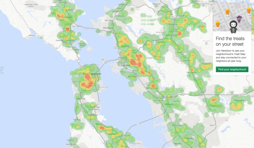
The trick-or-treating heat maps are generated based on the aggregate responses from Nextdoor members across 44,000 neighborhoods. To preserve the privacy of the our members, the heat maps do not zoom all the way down to street level. Using a gradient of green to candy-corn orange, the trick-or-treating heat maps quickly show the hot spots for candy in cities across the United States.

A snapshot of the best areas for trick-or-treating in the greater San Francisco Bay Area.

A closer look at San Francisco’s neighborhoods.
Now, if you’re particularly adventurous, you can use the Treat Map to make a beeline to the candy in your neighborhood and the heat map to find the other neighborhoods to head to before Halloween night is over.
This is just another way that we’re helping neighbors celebrate old traditions with new technology. We hope you enjoy the candy!
You can find more information on the Nextdoor Treat Map here. Are you a reporter interested in writing about how Nextdoor is helping neighbors across the country celebrate Halloween? Contact us here.
I wish this site got more publicity sooner. Maybe more ppl would sign up. We are in the North Bay and I can’t see us on the map